



Sailing around Menorca is about 70 miles of coastal hops, and most of its calas have no bar, no water and no road down to them. You reach them on foot along the Camí de Cavalls, or you arrive by sea. We sailed right round the island twice in 2026, in July out of Cala d’Or and in September out of Barcelona. Here is the island coast by coast: which way each anchorage opens, what each side asks of the weather, and which ports turn boats away.
Why the island gives itself up more easily from the sea
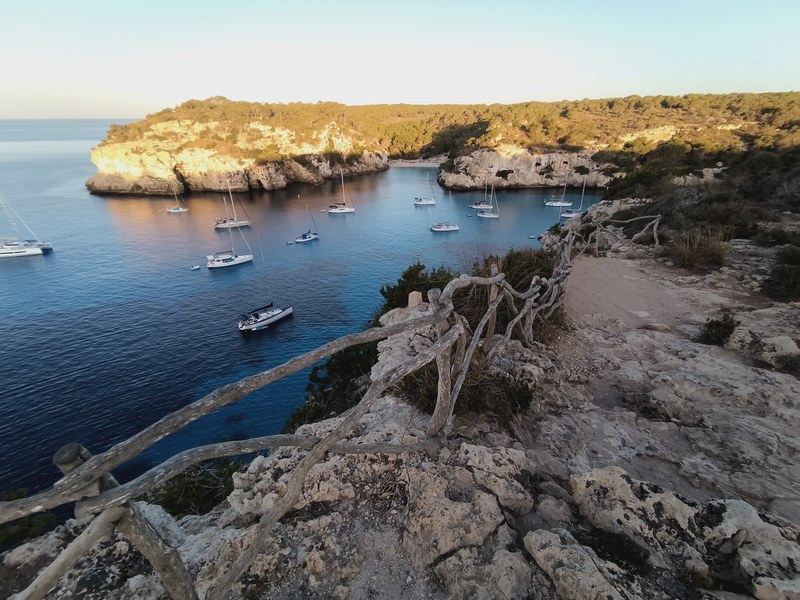
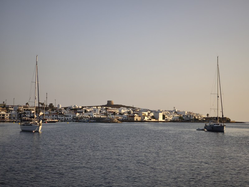
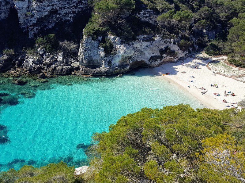
Menorca is hard to reach by land. Getting down to Turqueta, Es Talaier, Macarella, and to some extent Binigaus, means walking, usually along the Camí de Cavalls — a magnificent path, and often full of walkers. In the evening, once the last of them has climbed back to the car park, the only people left in the cala are the boats sleeping there; by first light the beach belongs to them, you step off the dinghy onto sand nobody has walked on yet, and you swim in water that has not moved all night. It is the one thing the coast sells nowhere: the hour of the day.
The four coasts, and what each one asks for
The south: the calas, and the hour to be there
This is the side of white sand and clear water: Son Saura, Es Talaier, Turqueta, Macarella and Macarelleta, then Mitjana, Trebalúger, Escorxada and Binigaus as far as Cala Coves. It all sits within a few miles — just over a mile from Turqueta to Macarella, four more to Binigaus, six again to Cala Coves — so the day is decided by where you stop, not by how far you go. The calas fill between eleven and five, and empty just as fast. At eight in the morning at Macarelleta there were two boats and two people on the sand.
The west: Ciutadella, the better of the two towns
Ciutadella is more authentic than Mahón, richer in history, with prettier streets, a centre worth walking, and a very handsome little port — a narrow canal running into the old town, lined with open boats and terraces, fish stalls at one end and the cathedral above. It is the one real evening ashore of the week, and it is worth arranging in advance: the canal has to be earned (see the ports table). North of the entrance the Pont d’en Gil opens its arch to the west, and you can anchor just beside it at the Racó de s’Amarador, 40.0121 N / 3.7945 E — the depth charts show nothing there, because their 116-metre grid cannot resolve the shelf against the cliff.
The east: Mahón, and what is worth more than Mahón
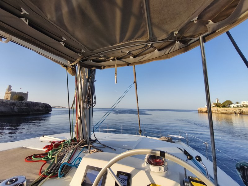
Plainly: we do not count Mahón among the outstanding stops. The town is heavily built up, the harbour entrance is long, and the fortress of La Mola, which genuinely repays a visit, is visited from the land — stopping at anchor to climb up to it is awkward. What to take on this coast lies a little further north: Illa d’en Colom, inside the s’Albufera des Grau natural park, a channel between the islet and the shore, a beautiful bottom, a well-sheltered anchorage from which you take the dinghy across to dinner at the village of Es Grau; and above it, the black slate of Cap de Favàritx and Platja de Tortuga, both of them wild. From there up to Fornells, the coast becomes genuinely beautiful.
The north: the least visited coast in the Balearics
The whole north is wild. Apart from the village of Fornells, the coast offers rock, red-gold sand and coves with nothing built on them: Cala Tirant, Pregonda, Cala del Pilar, Algaiarens, and Cala Morell with its necropolis cut into the cliff. It is the least touristed side of the whole archipelago, for a simple reason: it is only open when the tramuntana keeps quiet. When that wind blows, the north is off; when it lets you through, there are few boats, because few weeks allow it. One calm day on this coast is worth building the rest of the week around.
Which way each anchorage opens
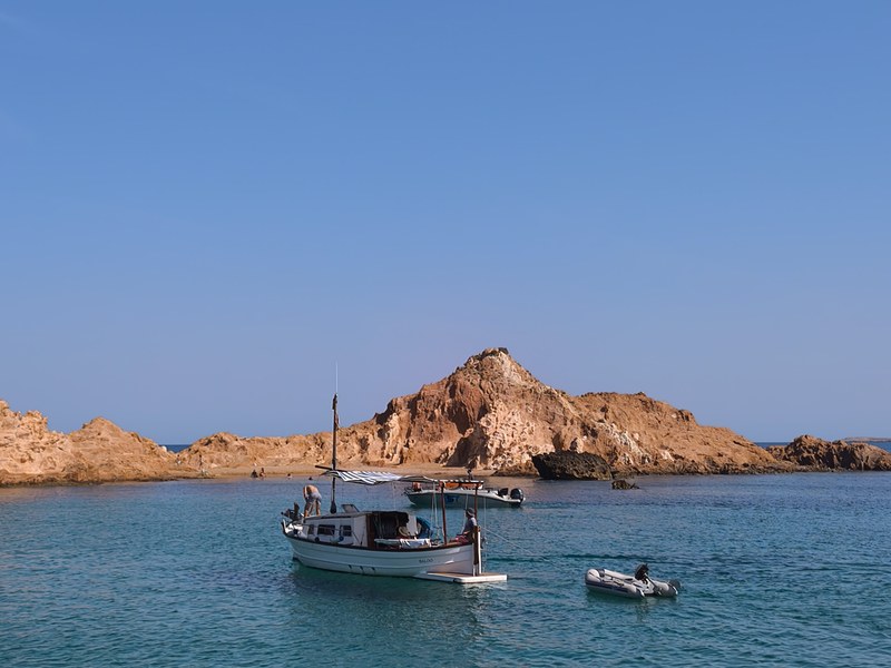
An anchorage shelters you from whatever lies behind it: its protection is written in the direction it faces. We measured that opening for twenty-six anchorages, casting rays at the coastline from a position in the water and keeping the widest sector with no land in it. Values are in degrees, 0° being north.
| Coast | Anchorage | Opens towards |
|---|---|---|
| South | Cala en Turqueta | SSE — 160° |
| South | Es Talaier | SSE — 168° |
| South | Macarella | S — 171° |
| South | Macarelleta | S — 171° |
| South | Cala en Bosc | S — 181° |
| South | Cala Galdana | S — 185° |
| South | Son Saura | S — 191° |
| South | Cala Mitjana | SSW — 194° |
| South | Cala Trebalúger | SSW — 198° |
| South | Cala Escorxada | SSW — 200° |
| South | Binigaus | SSW — 204° |
| South | Cala en Porter | SSW — 209° |
| South | Cala Coves | SSW — 211° |
| East | Sa Mesquida | ENE — 65° |
| East | Favàritx | E — 80° |
| East | Illa d’en Colom | E — 98° |
| East | Cala Rafalet | ESE — 102° |
| East | Cala Presili | ESE — 107° |
| North | Cala del Pilar | N — 3° |
| North | Fornells bay | N — 5° |
| North | Cala Pregonda | NNE — 17° |
| North | Cala Tirant | NNE — 18° |
| North | Cala Algaiarens | NNW — 337° |
| North | Cala Morell | NNW — 347° |
| West | Ciutadella canal | SW — 229° |
| West | Pont d’en Gil | W — 261° |
The orientation tells you which sector the cala is open to. On its own it does not tell you whether the night will be comfortable: that is decided by the day’s swell — its direction, and above all its period. Residual swell that wraps around the headland and enters through the open sector will roll a boat all night under a forecast that says calm seas.
Our two weeks show it. In July the night at Turqueta rolled — everyone aboard remembers it — and Macarella the following night was uncomfortable, with a north-westerly swell of 0.7 m at close to 6 seconds. In September the same Macarella did not move at all: 15 cm of northerly swell at 3.6 seconds, and no wind to speak of. Cala Coves, the Fornells buoy, Algaiarens and Illa d’en Colom were calm every time. We underestimated this once, on that night at Turqueta; it has been part of the calculation ever since, and it is the thing you are actually paying for — someone who knows which cala holds on that particular night.
What we look at without stopping
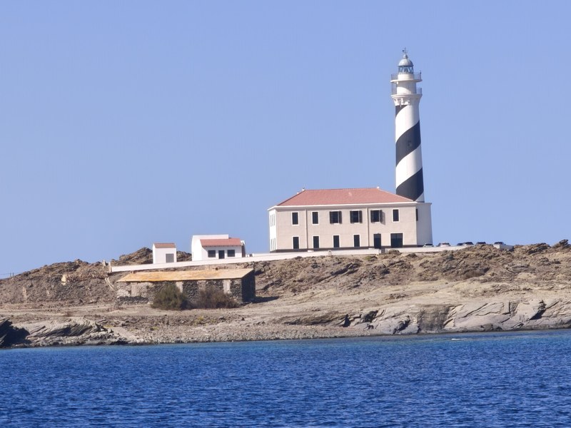
Not everything is an anchorage, and a good week is partly won by not stopping everywhere. Binibèquer Vell and its white lanes are looked at from the water: there is no real anchorage. Cap de Cavalleria and its lighthouse is a headland, and rather the opposite of shelter. La Mola and the entrance to Mahón are pleasant to run past without going in. The Artrutx lighthouse, a black-and-white banded tower on the south-western corner, is rounded early in the morning on the way from the west coast to the southern calas. And opposite Punta Prima, Illa de l’Aire carries the tallest lighthouse on the island.
Eating ashore, and why there is almost nothing
Menorca has almost no beach bars, and that is regulated. Son Saura, Es Talaier, Turqueta, Mitjana, Trebalúger, Fustam, Escorxada, Cala Tortuga, Pregonda, Cala del Pilar, Algaiarens: nothing at all. No bar, no water, no organised shade. That is exactly what makes them beautiful, and it means lunch is aboard by default.
The exceptions are few and good. Susy, at Macarella, a beach shack run by the same family since 1962, under the pines. Chiringuito Toni, feet in the sand at Cala Galdana, the one cala on the south coast where you can also reprovision. Tamarindos, on the beach at Es Grau, reached by dinghy from Illa d’en Colom. Ivette, at Cala Morell, right on the way between Algaiarens and the Pont d’en Gil. At Fornells the caldereta de langosta must be ordered ahead — the lobster comes out of the tank — at Es Cranc or Sa Llagosta. And in Ciutadella the port lines up S’Amarador, Café Balear and the Aquarium.
The ports, and what they actually accept
These rules were given to us in writing by the ports themselves during 2026. They shape a week more reliably than the weather does.
| Port | Size accepted | What to know |
|---|---|---|
| Ciutadella — Ports IB | 12.00 m × 4.00 m maximum | Above that it is no, with no discussion. |
| Ciutadella — Club Nàutic | up to 18 m | Five nights minimum in high season; out of season, call the same day. The berth is not free before 2 p.m., and there is no water service. |
| Fornells — Ports IB buoys | depends on the buoy | Booked on VHF 77. Taken from 11 a.m., released before 10 a.m., charter contract to be shown. |
| Mahón — Club Marítimo | — | Moll de Llevant, VHF 9. The only fuel station in the harbour, 8 a.m. – 9 p.m. daily in summer. |
| Addaia | ~15 m, tight | Narrow entrance. A fallback on the north coast rather than a destination. |
One local peculiarity is worth knowing: the rissaga, a seiche that can empty and refill the Ciutadella canal within minutes. It is forecast, it is watched before going in, and it concerns exactly one port on the island — the one where you sleep in town.
When to go
The useful season runs from 15 May to mid-October. Before 15 May the island is far quieter and it is more of an adventure: swimming and snorkelling are frankly cold, and the beach places have not opened. After mid-October the chance of a blow becomes high and the north coast closes for good.
| Period | What to expect |
|---|---|
| Mid-May – June | Empty calas, long light, water still cool early on. The north coast is on as soon as a lull settles in. |
| July – August | The most stable and the warmest, and the busiest: the southern calas fill up in the middle of the day and Ciutadella is hard to get into. |
| September | Our favourite. Water at 28 °C, the crowds receding, readable weather windows. |
| Early October | Still very good, but the tramuntana returns and the north becomes a maybe. |
Getting to Menorca
From Mallorca — about fifty miles. This is the start we propose by default: the crossing is absorbed into a day or an evening, and by morning you are among the south-western calas. That crossing and a full week are set out in our guide to sailing from Mallorca to Menorca.
From Barcelona — two of the seven days at sea. Around 110 miles out and as many back, roughly twenty hours each way. You board in the city, with no flight and no transfer, and you pay for it with two nights of watch-keeping. That is what we did in September 2026.
From Menorca itself. It can be done, and then the tour needs no crossing at all. But the charter fleet there is narrow: less choice, and a more expensive week for the same boat. From Cala d’Or, Palma or Pollença you pay less and you genuinely choose your yacht.
Common questions
How many days does it take to sail around Menorca?
Seven days, comfortably, if you start from the island: about 70 miles of coastal sailing, so two to three hours at sea a day and all the rest at anchor. Starting from Mallorca, the same week includes two crossings and comes to around 170 miles.
Which way round should you go?
Whichever way the forecast dictates. The direction is chosen a day or two before departure, so that the north coast falls on the calm window and the southern calas on the windy day. Reverse the forecast and you reverse the tour.
Can you sail round in a tramuntana?
Not the whole way round. In an established tramuntana the north coast is closed and the week is spent on the south and east, which is still a fine week. That is precisely why the north is so empty: it does not open every week.
Do I need any sailing experience?
No. Your professional skipper runs the boat all week. You take the helm as much as you like, or not at all.
Sailing Menorca with us
A week starts at €5,000 for the whole yacht, professional skipper included, your group alone aboard — provisioning, fuel and port fees are shared on top. See the Mallorca & Menorca odyssey or The Quiet Passage, read when to sail the Balearics, or send us your dates and we will tell you honestly what the week can look like.
5.0/5 on Google (8 reviews) and 4.3 on Trustpilot (9 reviews). 17 reviews from crews who actually sailed with us, on two platforms we cannot edit. Read every one of them.